By Marcin Wojtyczka
9 minutes readFundamentals of one of the oldest seamen’s skills and arts.
Introduction
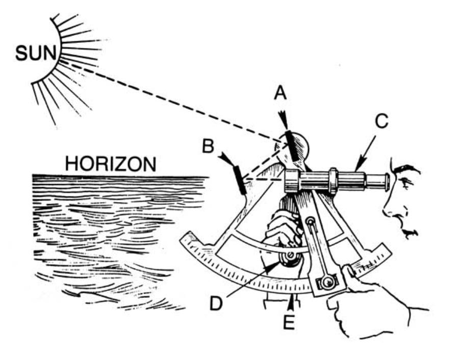
Celestial navigation, also known as astronavigation, is the ancient but still used practice of position fixing that uses “sights”, or angular measurements taken between a celestial body (e.g. the Sun, the Moon, a planet, or a star) and the visible horizon.
Before GPS became generally available in the early 1990s, astronavigation was the only method of position fixing available to yachtsmen on ocean passages. It was therefore a crucially important skill. Today satellite navigation is the primary means of position fixing for the vast majority of long-distance sailors. However, GPS is dependent on electric power and complex electronics, which cannot be repaired at sea. If your GPS fails for whatever reason (e.g. lightning), you can use astronavigation to navigate and is the only method of doing so that requires no electronics.
Sailing using just celestial objects is a really special experience and requires a completely different approach to navigation. When you are navigating out of sight of land you will not be able to pinpoint your position so accurately as with the GPS where you get an accuracy of 5 meters or so. On a small boat, you can expect an accuracy of 1 mile at most and only in favourable conditions. But the art of traditional navigation is not knowing where you are but where you could be. Your position is no longer a point, it is an area/circle. High accuracy is not required as long as there are no hazards in the vicinity - in the open ocean. It is far more important during landfall where you need to establish an actual position as soon as land comes into view (lighthouses and high land features).

To make navigation simple it is better to keep the ship's time in one zone (perhaps UTC). Time changing underway, as you cross meridians, adds overhead and confusion to navigation. If you can live with the fact that for example, midday might be 6 pm on the watch by the time you arrive, it is better to stick to one time zone.
What do you need
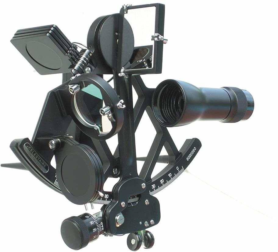
- Sextant to measure celestial body altitude above the horizon
- An accurate watch with a second’s precision. The best is a simple digital Casio watch with an LED light that you can buy for 18 Euros or so. Just make sure to check how many seconds it loses or gains every week or month.
- Nautical almanac and sight reduction tables
- Plotting sheets
Procedure
Getting position fix using celestial navigation is quite simple using tables, but there are a lot of detailed steps to be followed. We do not have a space for this here but there are a lot of publications and courses that can teach you this (see section below). From a very high-level perspective, these are the steps:
- Establish a Dead Reckoning (DR) position
- Take the sextant sight(s) and read the time
- Use nautical almanac and sight reduction tables to reduce the sight
- Draw position line(s) on the plotting sheets and read off your observed position (where the position circles cross)
Learning
Celestial navigation can be a very intimidating subject. It is indeed a complex topic but only if you want to understand every detail of it. Luckily enough, it is fairly easy if you just want to use it. You will have to master the use of the sextant and perform simple calculations with the help of a nautical almanac and sight reduction tables.
Books
Celestial Navigation - With the Sight Reduction Tables from Pub. No 249 - Dominique Prinet - very clear explanation on how celestial navigation works and how to use it without bogging down in theory
Courses
RYA Yachtmaster Ocean theory course - will teach you how to use a sextant, how to do the calculation using the tables, introduce you to worldwide meteorology, passage planning and communications for bluewater sailors
Buying a sextant
If you want to get good sights, you need a decent sextant. A very good article on that subject can be found on Celestaire.
Choose a metal sextant and avoid plastic models for better durability and accuracy. A metal frame ensures greater stability, reducing the need for frequent error corrections. German sextants are among the best on the market, though they tend to be more expensive. The most well-known brands are Cassens & Plath and Freiberger. If you’re looking for the best price-to-quality ratio, I recommend the Astra IIIB Deluxe Sextant.
A whole-horizon mirror is generally easier to use than a split mirror.

I would recommend buying a new sextant and only consider the old one if someone very experienced in this subject can verify it for you. These devices are quite delicate and precise. If they have any flaws, you will not be able to get good sights.
Using a sextant
This PDF includes the following:
- Introduction to Celestial Navigation
- General information on how sextant works
- How to use to take sights of sun, moon, planets and stars
- Sextant errors and corrections
- How to navigate without a GPS and Sextant, just with the use of a stick
- How to draw your own plotting sheets if you run out of them on the sea
Video on how a sextant works and how to use it
Required publications
Below you can find a list of publications required for the calculations:
Nautical Almanac
Sight Reduction Tables Pub. No. 249
These tables were originally designed for air navigation, but they have become popular with sailors. It replaces 6 volumes of Pub. No. 229 with 3 volumes set that cover all latitudes and declinations from 0° to 29° north or south. This covers the sun, moon, planets, and only those stars whose declinations fall into this range. These stars, if observed on some unlikely occasion, say through a break in the overcast, could not be computed using the 249 tables. Nevertheless, this remains the most popular tabular system in use.
Volume 1 should be replaced every 5 years, labelled by the Epoch year, with the data being valid for the 2 years before and after the Epoch year. It provides the computed altitude to the nearest minute and true azimuth to the nearest degree for the seven best stars suitable for a fix from any latitude and any local hour angle of Aries. The best stars are chosen based on magnitude and azimuth for a three-body fix to achieve optimum viewing and direction.
Volume 2 is designed for use for latitudes between 0° to 40° and Volume 3 for latitudes between 39° and 89°. These two volumes like Pub. 229, never need replacing since they solve only spherical triangles for all table entries. They provide a Hc to the nearest 0.1′ and an azimuth angle (not true azimuth as in Vol. 1) to the nearest degree. The Hc is corrected for the difference between tabulated declination and true declination using Table 5.
Universal Plotting Sheets for Celestial Navigation
You need to print plenty of them either in A3 or A4 format.
Celestial Navigation Work Forms
You need to print plenty of them, especially the Sun Sight forms that you will use most often.
Astronavigation Proformas (PDF)
A complete set of forms includes:
- Meridian Altitude (Noon) Sun Sight
- Sun Sight
- Star Sight Plan
- Star Sight Reduction
- Moon Sight
- Planet Finder
- Planet Sight
- Polaris ProForma
- Compass check on the sun
Compass Deviation Card
If steering compass deviation is doubtful or unknown because you are on a boat that you do not know, you should verify it, especially before a longer trip. It is not a bad idea to prepare a deviation card. A rough but reliable guide to the deviation on a single course can be obtained if you stand in the stern, well away from any magnetic influences, and sight through the mast and bow with a hand-bearing compass. Compare the reading obtained with that shown by the steering compass and any difference will be the deviation on that heading (if the steering compass reads higher than the hand-bearing compass, the deviation is westerly, otherwise easterly). By repeating this procedure for each of the headings (say every 45 degrees), you can produce your own deviation card for the steering compass.
Online publications
The Nautical Almanac and Sight Reduction tables are available online for free in PDF format: https://thenauticalalmanac.com/
The main advantage of using these tables, apart from the price, is that you can print the relevant pages for your trip without carrying all the books.
To have a complete set for navigation you need to download:
Nautical Almanac
- Daily Pages**
- Increments & Corrections for Sun, Planets, Aries, Moon (the Yellow Pages)*
- Conversion of Arc to Time*
- Altitude correction tables for Sun, Stars and Planets*
- Altitude Correction Tables for the Moon*
- Equation of Time for the Sun*
- Optionally Moon phases**
Sight Reduction Tables for Air Navigation Pub. No. 249 - Volume 1*, 2* and 3***
You only need the relevant pages for a given date and latitude.
Table 5 - Correction to Tabulated Altitude for Minutes of Declination*
This is also included as part of the Sight Reduction Tables Vol 2 and 3.
Polaris - Corrections Q*
Visibility of Planets & Local Mean Time of Meridian Passage**
This provides valuable information on planetary visibility throughout the year, along with a Local Mean Time of the Meridian Passage chart. With this chart, you can quickly determine which planets will be visible on any given day, saving time compared to manual calculations. You may find this information on the Nautical Almanac website or in the Astronomical Phenomena publication.
*what does not change**what you need to update every year***what you need to update every 5 years
Practice, Practice, Practice …
Like with every new skill the more you practice, the better you will be. For taking sights you do not necessarily have to be at sea away from land. You can practice at home by taking sights at arbitrary celestial objects, and if you can create artificial horizon, you can also establish your position. You can practice on a beach or anchor whenever you can see the horizon, and finally when you are sailing at sea. Taking sights when the boat is moving even in rough conditions is easier than you might think.
With lots of practice and patience, you should be getting sights accurate to a mile or so.
Fair Winds and Following Seas!
- Related articles:
- Navigation